
Land Clearing & Defensible Space in Sutter Creek, CA
Wildfire Fuel Reduction, Brush Removal & Land Clearing for the Jewel of the Mother Lode and the Ridge Road Ranch Country
Defensible Space for the Jewel of the Mother Lode
Brushtech Land Management serves Sutter Creek, the "Jewel of the Mother Lode" – a beautifully preserved Gold Rush town of roughly 2,650 on Highway 49, built on quartz-lode gold and home to the Knight Foundry, the last water-powered foundry and machine shop in the United States. Main Street threads through a steep, oak-wooded canyon along the creek, while the land opens into ranch and vineyard country along Ridge Road and Shake Ridge Road to the east.
It is also some of the highest fire-risk ground Brushtech works. The majority of Amador County is classified as High or Very High Fire Hazard Severity, and the county ranks among the highest in the nation for wildfire risk to homes. The 2015 Butte Fire, which ignited just down Highway 49 near Jackson, made that reality impossible to ignore. Brushtech answers it with defensible space and fuel reduction for homes in town and out on the ridges, oak-woodland thinning, brush and chaparral clearing, and the dirt work that keeps the surrounding ranch and vineyard parcels usable and protected.
Land Management Services in Sutter Creek
Fire-forward land management built for Sutter Creek's steep canyon townsite, oak woodlands, and the ranch and vineyard country east of town

Brush Removal & Fire Breaks
This is where Brushtech starts in Sutter Creek. The crew builds defensible space and clears large-area fuel for homes in the creek canyon and out on the ridges, working some of the highest fire-hazard terrain in Amador County to slow a fire down before it reaches the structure.
- 100-foot defensible space zones
- Large-area fuel reduction on ridges and slopes
- Brush and chaparral clearing
- Fire breaks along property edges

Vegetation Management
Oak woodland and chaparral grow back fast in this climate. Brushtech thins overgrown oak woodland and runs seasonal brush, grass, and chaparral control along Ridge Road, Shake Ridge Road, and the Sutter Creek-Volcano Road corridor to keep fuel loads down year after year.
- Oak-woodland thinning for fuel reduction
- Seasonal grass and brush control
- Chaparral management along ridge roads
- Recurring maintenance programs

Land Clearing
The ranch and vineyard parcels east of town carry heavy brush and overgrowth. Brushtech clears it selectively, leaving the valuable oaks standing and working the rocky foothill soils to open ground up for grazing, planting, or building.
- Brush and overgrowth removal on acreage
- Selective clearing that preserves oaks
- Vineyard and ranch parcel preparation
- Work suited to rocky foothill ground
Hazard Tree Removal
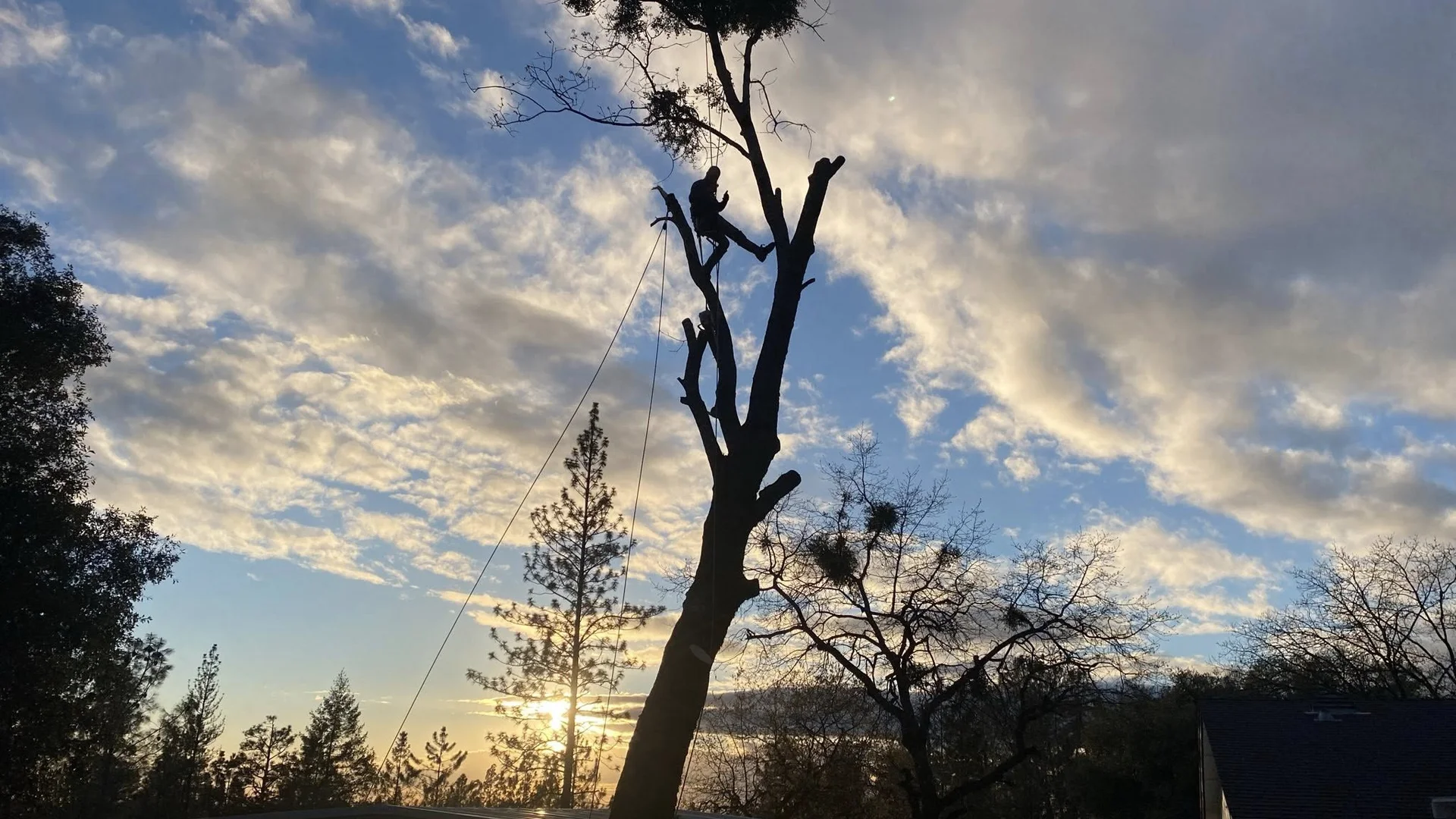
Dead and dying oaks and grey pines are both a fire hazard and a falling risk in this terrain. Brushtech removes hazardous and storm-damaged trees near homes, along Sutter Creek, and on the steep slopes wrapped around the historic core.
- Dead and hazardous oak removal
- Grey pine and storm-damaged tree removal
- Deadwood removal for fire safety
- Safe felling on steep canyon slopes

Dirt & Gravel Road Work
Ranch and ridge access matters most when a fire truck needs to get up the grade. Brushtech builds and maintains gravel roads, driveways, and drainage on the steep foothill terrain around Sutter Creek so access holds up through wet winters and fire season alike.
- Ranch and ridge access roads
- Driveway construction on steep grades
- Drainage and culvert work
- Gravel road grading and repair

Excavation & Haul Off
For ranch and vineyard improvements, Brushtech handles the earthwork and the cleanup, cutting pads, shaping drainage, and hauling off cleared brush and debris so the project finishes clean and the fuel leaves the property for good.
- Pad and building-site excavation
- Drainage shaping and grading
- Cleared brush and debris haul-off
- Earthwork for ranch improvements
Sutter Creek Areas Served
Serving the historic townsite, the surrounding foothill communities, and the ranch and vineyard country east of Sutter Creek
Historic Downtown & Main Street
The Gold Rush commercial core sits in the creek canyon, lined with the cantilevered-balcony brick storefronts that earned Sutter Creek its reputation. Brushtech works carefully here, removing hazardous trees and clearing brush on the steep lots that wrap the historic district without disturbing the character that defines it.
Sutter Hill
Just south on Highway 49, the unincorporated Sutter Hill community and commercial area blend homes with foothill open space. Brushtech provides defensible space clearing, brush removal, and seasonal vegetation control to keep these properties fire-safe along the wildland edge.
Ridge Road & Shake Ridge Road
East of town the land opens into ranch and vineyard country, including operations like Avio and Shake Ridge Ranch. Brushtech handles land clearing, oak-woodland thinning, and fuel reduction across these larger parcels, plus the access roads that serve them on steep ground.
Sutter Creek-Volcano Road Corridor
Heading east toward Volcano, properties grow more remote and more heavily wooded. Brushtech delivers large-area fuel reduction, brush clearing, and access-road work for the rural homes and ranches strung along this corridor.
Sutter Creek Riparian Corridor
The creek itself runs through and below town, carrying dense streamside growth that adds to the fuel load. Brushtech clears brush and removes hazardous trees along the riparian corridor while respecting the watercourse and the slopes that feed it.
Martell Edge
Along Highway 49 south toward Martell and Jackson, Brushtech serves the homes and parcels on the city's southern edge with brush removal, defensible space, and fuel reduction in the same high-hazard foothill terrain that runs through the rest of the county.
Driving Directions to Sutter Creek
From Jackson
Via Highway 49 North (10 minutes)
- Take Highway 49 north out of Jackson
- Continue through Martell
- Follow Highway 49 into Sutter Creek
- Main Street is at the canyon floor
Distance: ~4 miles | Time: ~10 minutes
From Amador City
Via Highway 49 South (5 minutes)
- Take Highway 49 south from Amador City
- Continue a short stretch through the foothills
- Descend into the Sutter Creek canyon
- Arrive at the historic district
Distance: ~2 miles | Time: ~5 minutes
From Plymouth
Via Highway 49 South (15 minutes)
- Take Highway 49 south from Plymouth
- Pass through Drytown and Amador City
- Continue into Sutter Creek
- Follow signs to Main Street
Distance: ~8 miles | Time: 12-15 minutes
From Placerville
Via Highway 49 South (35 minutes)
- Take Highway 49 south from Placerville
- Wind through the El Dorado County foothills
- Cross into Amador County toward Plymouth
- Continue south into Sutter Creek
Distance: ~25 miles | Time: 35-40 minutes
Local Landmarks Near Sutter Creek
Sutter Creek sits right on Highway 49 in the heart of Amador County's Gold Country. Look for these well-known landmarks:
- Knight Foundry - 81 Eureka Street (last water-powered foundry in the U.S., est. 1873)
- Historic Main Street - the 19th-century commercial district with cantilevered balconies
- Sutter Creek Theatre - 44 Main Street (1919)
- Monteverde Store Museum - Main Street general store, opened 1896
- Miners Bend Historic Gold Mining Park
Weather & Seasonal Challenges in Sutter Creek
Understanding the upper-foothill climate that drives year-round fuel reduction and land management
Summer Season (June - October)
Temperature Range: 90-91°F daytime, ~64°F nights
Conditions: Hot and essentially rain-free, with heavy fuel curing across the oak woodland and chaparral. This is peak fire season in the Mother Lode.
Challenges & Solutions:
- Peak fire danger: Cured grass, brush, and chaparral on canyon walls and ridges create extreme conditions. Defensible space and fuel reduction must already be in place.
- Steep, dry slopes: Fire moves fast uphill in this terrain. Fuel breaks and thinned woodland slow it before it reaches homes.
- Heat and crew safety: Intensive clearing is scheduled for early hours for equipment efficiency and worker safety.
- Dried vegetation: Dead brush on ranch and vacant parcels becomes a hazard. Clearing keeps properties compliant with fire requirements.
Winter Season (December - March)
Temperature Range: 52-54°F daytime, 38-41°F nights
Conditions: The wettest months, with January and February sometimes seeing 5-7 inches of rain and rare light dustings of snow possible on the higher ridges.
Challenges & Solutions:
- Rain delays: Heavy storms pause clearing and earthwork. Projects are scheduled around dry windows between systems.
- Muddy, steep ground: Saturated foothill soil affects access. Proper equipment and timing minimize disturbance on the grades.
- Drainage and erosion: Canyon and ridge lots need careful grading to shed winter runoff without washing out roads.
- Storm damage: Winter winds bring down weak oaks and grey pines. Emergency hazardous tree removal is available.
Spring Season (April - May)
Temperature Range: ~69°F daytime, ~48°F nights
Conditions: Mild weather as brush and grass surge after the winter rains. This is the critical clearing window before the fuel cures and fire season sets in.
Challenges & Solutions:
- Best clearing window: The prime time to establish defensible space and reduce fuel before summer dries everything out.
- Rapid regrowth: Grass and brush explode after the rains. Spring vegetation control resets the fuel load for the season.
- Workable ground: Drying soil makes spring ideal for land clearing and access-road work on the ranch parcels.
- Busy season: Demand climbs ahead of fire season. Booking in late winter secures a spring slot.
Fall Season (September - November)
Temperature Range: ~75°F daytime, ~53°F nights
Conditions: Warm and dry, with elevated fire danger holding until the first rains finally arrive, typically in late October or November.
Challenges & Solutions:
- Extended fire danger: The hazard stays high through October across the oak woodland and chaparral. Defensible space must hold.
- Leaf and limb drop: Oaks shed leaves and deadwood. Fall cleanup keeps properties tidy and fire-safe.
- Last clearing window: A final chance to finish fuel reduction and earthwork before winter storms close the ground.
- Cooler working weather: Moderating temperatures make fall a productive stretch for clearing projects.
Elevation-Specific Considerations
At roughly 1,188 feet in the upper foothills, Sutter Creek sits higher and wetter than most of the Gold Country towns in the area, which shapes how the work gets planned:
- Wettest winters, very dry summers: The higher elevation brings around 28-30 inches of rain a year, then long rain-free summers that cure heavy fuel and feed an aggressive fire season.
- Canyon-and-ridge terrain: Steep slopes drive fast fire spread, so defensible space and fuel breaks are sized for the grade, not just the property line.
- Heavy oak and chaparral fuel: Dense woodland and brush are the basis for Amador County's High and Very High hazard classification, making ongoing thinning and clearing essential.
Why Choose Brushtech in Sutter Creek
High-Fire-Risk Specialists
Brushtech builds defensible space and fuel reduction sized for some of Amador County's highest-hazard ground, the steep, oak-and-chaparral terrain where wildfire moves fastest.
Ranch & Vineyard Land Work
From land clearing to oak-woodland thinning, Brushtech works the larger ranch and vineyard parcels along Ridge Road and Shake Ridge Road, including the access roads that serve them.
Historic Town Experience
The crew handles careful tree and brush work in the steep, oak-wooded canyon core, protecting homes and the historic district without disturbing what makes Sutter Creek special.
Licensed & Insured
Fully licensed and insured, with permitted work coordinated to meet Amador County and CAL FIRE defensible space and fuel-reduction requirements.
Frequently Asked Questions - Sutter Creek
How serious is wildfire risk in Sutter Creek?
It is among the most serious in the region. The majority of Amador County is classified as High or Very High Fire Hazard Severity, and the county ranks among the highest in the nation for wildfire risk to homes. The 2015 Butte Fire, which started just down Highway 49 near Jackson, showed how quickly fire moves through this foothill country. Defensible space and fuel reduction are not optional here, they are how homes survive.
Do you create defensible space for homes both in town and out on Ridge Road or Shake Ridge?
Yes. Brushtech builds 100-foot defensible space and reduces fuel for homes in the creek canyon townsite and for properties spread out along Ridge Road, Shake Ridge Road, and the ridges east of town. The clearing is sized to the terrain and the fuel around each structure.
Can you clear and thin oak woodland on ranch and vineyard parcels east of town?
Absolutely. Brushtech clears brush and overgrowth and thins oak woodland on the larger ranch and vineyard parcels along Ridge Road and Shake Ridge Road, using selective clearing that preserves the valuable oaks while opening ground up and cutting the fuel load on rocky foothill soils.
Do you remove hazardous trees in the steep historic canyon core safely?
Yes. Brushtech removes dead, hazardous, and storm-damaged oaks and grey pines near homes, along Sutter Creek, and on the steep slopes around the historic district. The crew has the equipment and the experience to fell and remove trees safely on the canyon grades without damaging surrounding property.
Are you licensed and insured, and do you coordinate with Amador County and CAL FIRE requirements?
Brushtech is fully licensed and insured, and handles permitted work so it meets Amador County and CAL FIRE defensible space and fuel-reduction standards. Brushtech keeps your clearing in line with local fire requirements so your property stays compliant and protected.
Ready to Start Your Sutter Creek Project?
Get a free quote for professional defensible space, brush removal, and fuel reduction in Amador County